
There are beautiful and places on earth and I have seen some. But there are also stunning places – places that would make you question reality and stuff that mother earth is made of. Kijululo Valley on Lorruka Hills, Kajiado west, is such a place.
I didn’t know it existed until I saw it. I was both surprised and awed. We were approaching the summit of Lorruka Hills – not an easy climb and our focus was the summit, get some rest before figuring out how to descend. Then on the right, the mountain suddenly folded it shoulders, displaying a deep valley. I first thought it was a crater but no…it stretched down making a seasonal river that drains its juices to the lowlands.
 The Maa people call it Kijululo because it literally means that – “the hanging one.” From the top, it is truly beautiful, with vegetation and rugged rock formations. My first reaction was how to get down into the valley but my tired legs quickly reminded me that I will have to find a way back on a 60-degree climb. I resigned my energy to admiring the place by dangling my legs on the cliff – enjoyed the breeze and the expansive country that stretched towards Mount Suswa. This is the moment that every follower of Jesus Christ sings the song “This is the day that the Lord has made…”
We left for the summit but I must return some day to go down to the belly of this mountain. I want to feel the warmth of Kijululo.
We started this hike with a little controversy: The name. Some write it as Lorruka, others Loorruga or Oloorruga. It’s a matter of phonetics depending on your Maasai dialect or which part of the Maa nation you come from. The controversy is the difference in the pronunciation of “ka” and “ga”. Locals here write it as Loorruka.
I have probably driven past this mountain many times on my way to Magadi or other fancy places. The thought of climbing Lorruka came to mind when my hiking partner enquired about it as we drove past. The little that I knew was that it was part of Enkusero Sambu Conservancy – managed by a friend, Paul Kilelu.
We called him and planned to visit the following week.

We picked up a guide from a junction just past Olepolos Resort but before you reached Oltinga centre on Magadi Road. We turned right towards the mountain. There are a number of villages and a school along the way. The area is dry, rugged – volcanic formations and acacia trees.
The mountain is long and soft from a distance, but from my experience, mountains and hills of the Rift Valley are deceptive. They are multilayered, rough and unforgiving. They smile but slap you at the same time.
 We were five hikers and two rangers from the conservancy. As we got ready to hit the trail, I looked around and started worrying if all of us will make it to the summit.
I looked at the mountain again, as if to ask it to be gentle on us – just for today. Let it not mute the zeal of those who made an effort to visit.
We had our first casualty in the first 500M. It was very steep, loose rocks and the sun did not help. The 20-year old lady did not take it kindly and decided to give up the fight. We left her with one ranger to make a decision whether to return to the vehicle or stay cool under some tree. She later made it to the summit with a lot of energy and surprisingly led the troop down on our return.
The mountain has a lot of peaks. The hiking trail is still not well developed and one needs to be ready to walk through the thorny bushes. Reaching the top of the first hill gives you amazing views and features of the different parts of the mountain. It will also give you an option to go straight to the summit which is short but steep or take a longer route that takes time but exposes you to more beautiful views.

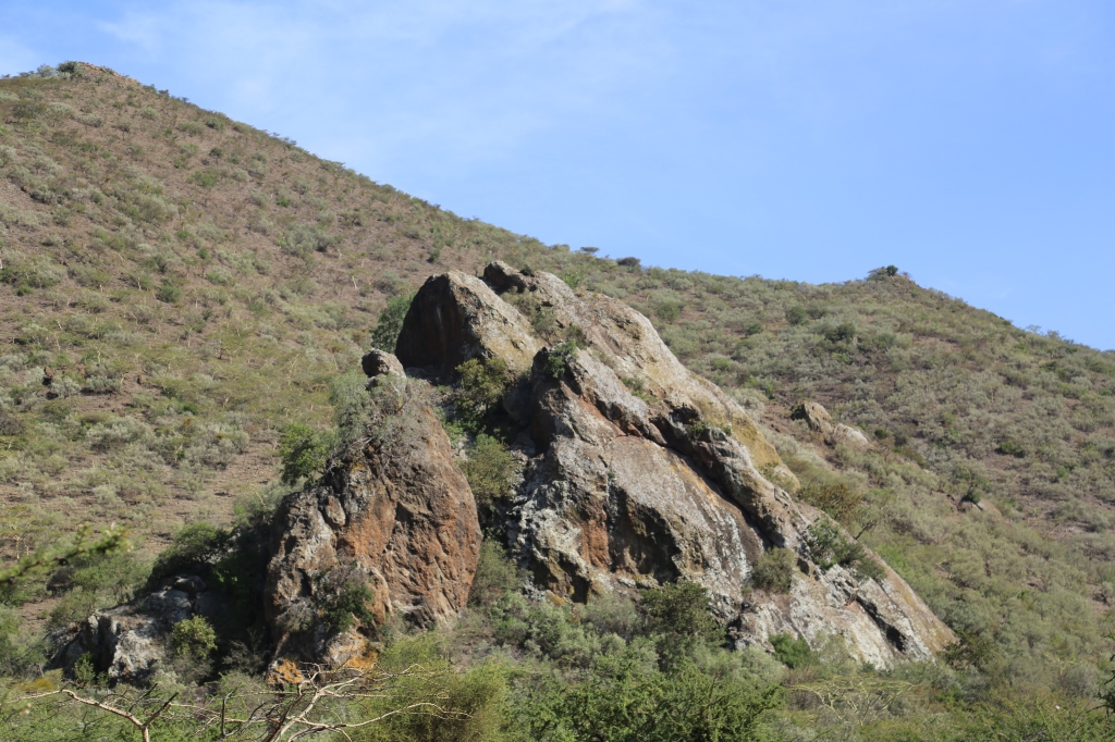
We took the longer route, turning east towards a massive outcrop of Esoit Pus (the Blue Rock). It looks impenetrable, sitting at the base of the mountain. We made an effort to climb it and spooked a huge stripped hyena that has made it home. It bolted away towards the valley.
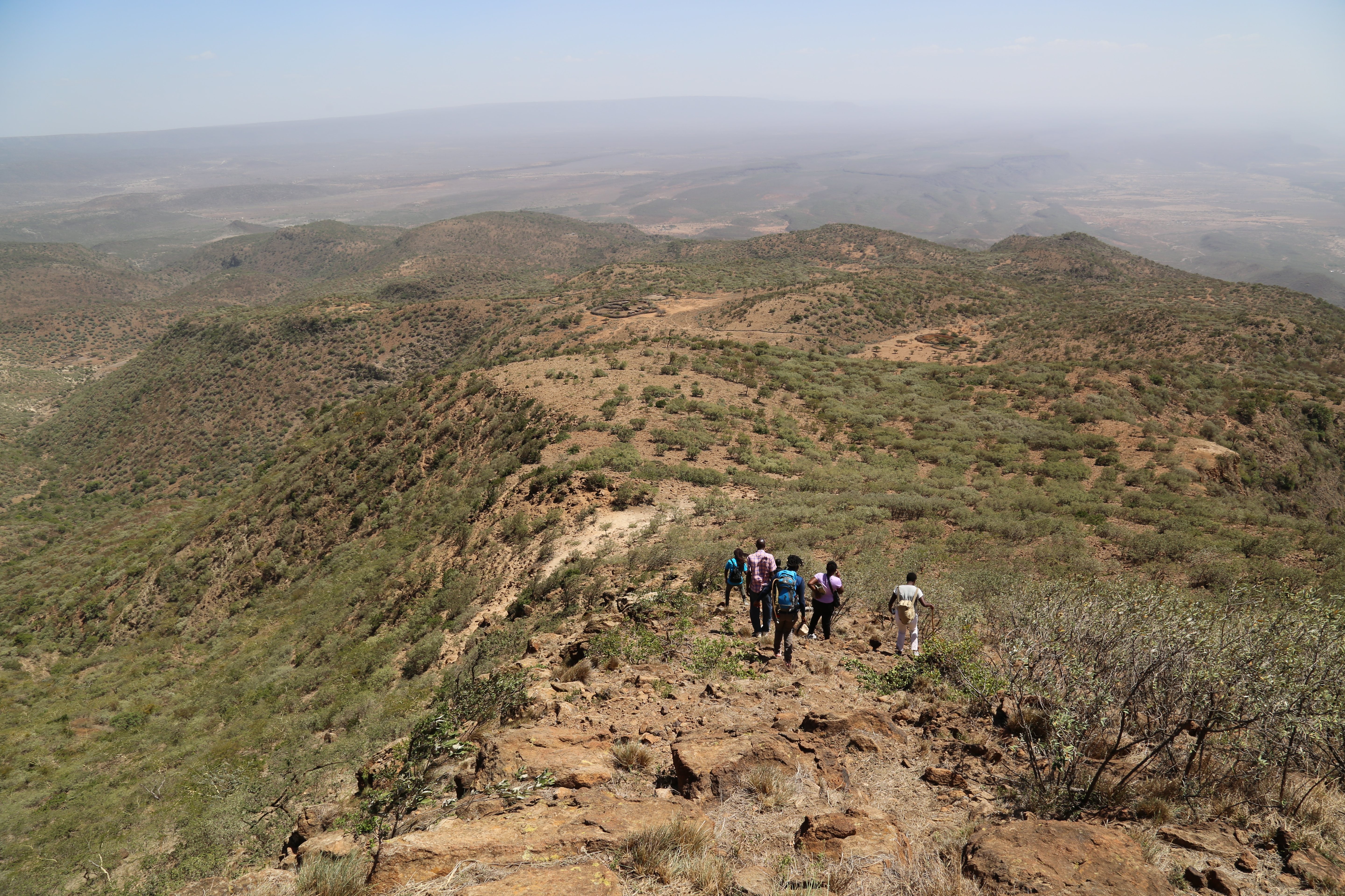
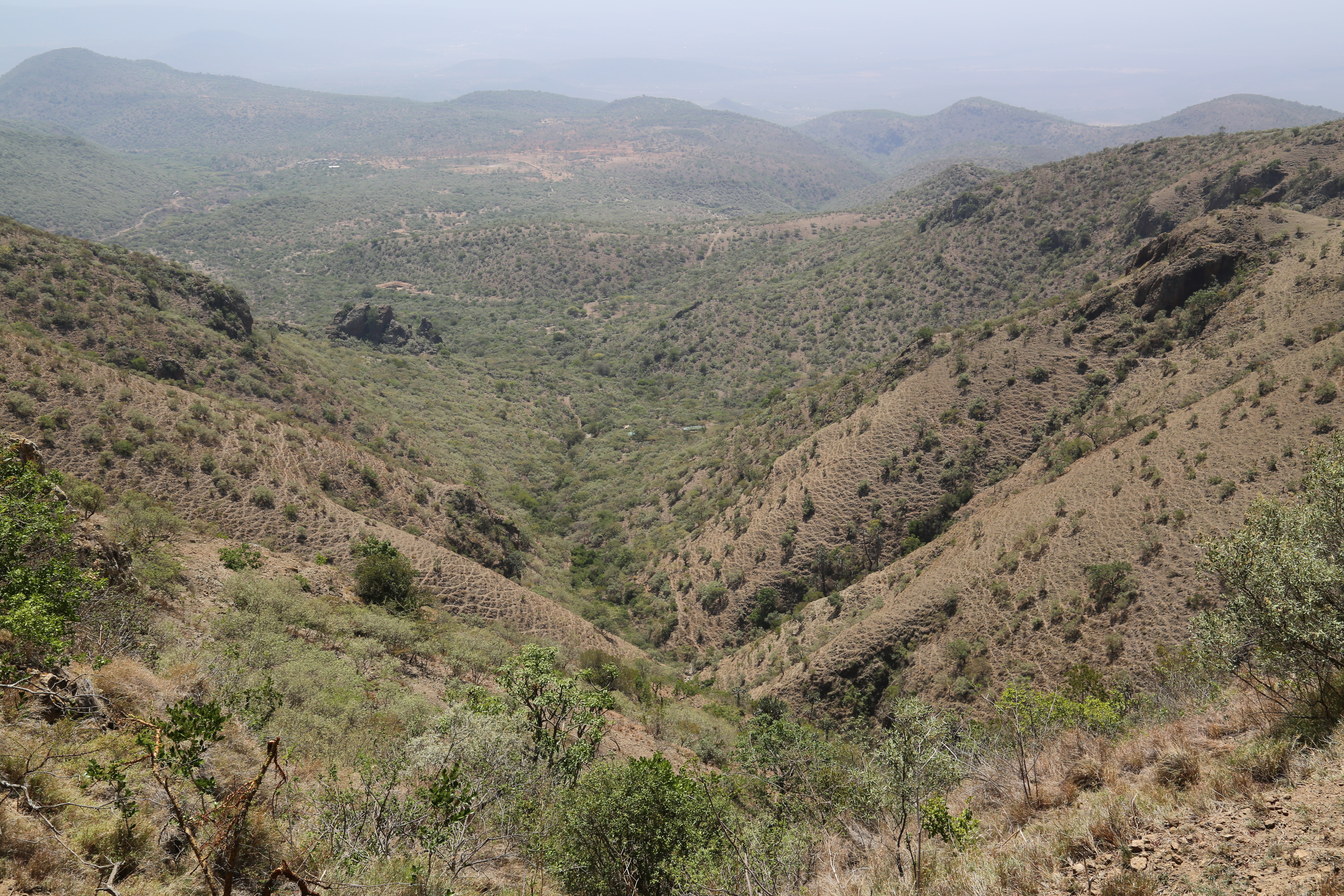
Further east we could see Enkusero Sambu settlement with its overgrazed neighbourhood with red soil and a school. Below, in every direction, are V-shaped valleys. Ngong Hills (Oldoinyo Loolaiserr) cropped up from the horizon, dark and long from the east. Mt. Loorgesaile occupied the Southern horizon. The rock hyrax and other antelopes made noises, warning of our presence. Falcons and hawks danced in the sky. Not a lot of livestock here but cowbells could be heard from a distance.
 Enkusero Sambu Conservancy is notorious for its leopards – known for their appetite for livestock. There are a few lions here but the numbers have been dwindling due to the conflict with livestock owners.
Approaching the summit from the east gives you the privilege and the surprise of walking along the rim of Kijululo Valley. Facing west is a famous tree where the Maa people carry out sacrifices in times of crisis – asking Enkai to intervene by giving rain. A little to the south of the steep valleys is the source of the whitest fluorspar (Enturoto) that is extracted for various rites of passage ceremonies for generations past.
It was time to descend and the hikers looked motivated. The young lady who almost gave up in the morning looks strong and had created a bond with the rangers. I looked down the valley and brazed for the trot because it is near impossible to go down very slowly. I also figured out that the rangers grew up here – they can climb and descend from any angle like the rock hyrax – they know the terrain but not necessarily trained as guides for inexperienced hikers.

Our next stop on our way down is a cave where Maa warriors use as a meat camp – a place to strengthen muscle, bond, and retreat from noise. The drop to the cave was steep and through thorny bushes but the hikers held their fort. The cave has a well that is fed by rain but hidden from evaporation by its walls. There are generational footprints from years gone marked by the red ochre on the walls. The trees too have marks that told us of those who were here before us – the warriors made marks that showed how long they lived in the cave.
The hike was 8.5kms but it could get much longer depending on one’s starting point.
We arrive at the vehicle to the glory of tea and chapatti made by our gracious host!
That was Enkusero Sambu Conservancy and Kijululo Valley!
